Cheyenne Mountain State Park Trails
The park boasts 21 trails, totaling over 27 miles, traversing different ecosystems and providing a great variety of views and experiences for all users. Trails range from short and easy to long and extreme. The park map provides a nice overview of the trail system. To protect this fragile ecosystem, dogs are allowed on designated trails only. Visitors are encouraged to report interesting wildlife sightings.
The long awaited Dixon Trail system that reaches the top of Cheyenne Mountain is now open! While these trails will access phenomenal views, a 1957 plane crash site, and overlooks of Colorado Springs and beyond, the 17+ mile roundtrip comes at a steep (pun intended) cost. Come prepared as there are NO pick up points along the trail and NO opportunities to refill water.
- Cheyennee Mountain Trail Use Map (Scroll to the boron of the page)
- Cheyenne Mountain Dog Trails Map
Acorn Alley Trail
0.53 miles of easy hiking or biking along a gentle slope on a universally accessible pathway. This trail circles North of the campground. Pet friendly.
Archer’s Alley
A 0.28 mile, easy trail that leads to the archery target ranges to the North or to the Field/3D range to the South.
Bear Track
A 0.95 mile trail dividing into the two legs that make up the Field/3D range. Not just for archers, this trail offers wildlife viewing opportunities that include red-tailed hawks, rattlesnakes, turkey, and black bear (not just the 3D kind!) Remember that this is an archery range, it is imperative that users Stay the Trail!
Blackmer Loop Trail
3.52 miles of moderate trail with moderate elevation gain. A park staff favorite because of great pines and rock gardens along the way. Visitors can even view a stunning pine growing out from a boulder.
Bobcat Way Trail
0.40 mile of easy, gentle slope. Lying to the North of the campgrounds, it can be linked with Acorn Alley and Soaring Kestrel trails to add length and variety. Pet friendly.
Boulder Run Trail
A one-mile moderate trail with some elevation gain offering a nice view of park open space and the Limekiln Valley, an active wildlife corridor.
Coyote Run Trail
A 1.37 miles of easy to moderate, gentle sloping interpretive trail that’s close to the visitor’s center. Great for a learn-as-you-go experience, a great horned owl has been spotted here. Let the visitor’s center know if he appears on your journey.
Cougars Shadow Trail
A 0.85-mile, moderate, thick forest and nicely shaded single-track trail ideal for mountain bikes.
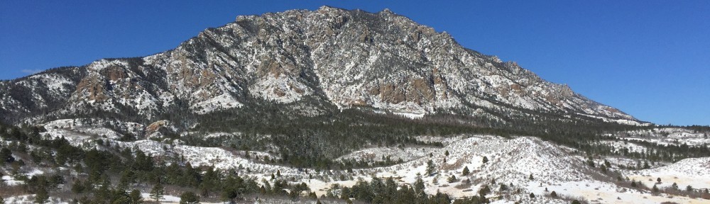
Dixon Trail
A 4.5 mile one way trail rated difficult to extreme. This trail is accessed from Limekiln Trailhead by taking Talon and N. Talon trails. From there, long switchbacks will take you up through the valley, past stunning rock formations, and even a 1957 plane crash site. This trail is for hikers only until the trail is completed. Bring plenty of water and prepare for fast changing weather. Elevation gain is about 2,500 feet. Bikers and Equestrian users are allowed to the 2.5 mile mark, where a nice turnaround point offers a hitching post, rock bench seating and great views. Past this 2.5 mile mark the Dixon trail is open to Hikers Only due to its steep grade and tight, rocky switchbacks. No dogs are allowed on the Dixon trail, please refer to the dog trail map for which trails are dog friendly.
Dragon’s Backbone
A 0.85 one way trail rated extreme. This trail follows the rocky ridgeline that comprises the top of Cheyenne Mountain. It can only be accessed by taking a 17+ mile round trip hike from Limekiln Trailhead. The views from atop its overlooks are worth every grueling, rocky step. Hikers Only.
Little Bear
A 0.1-mile easy, flat connection trail near a prairie dog town. Take time and enjoy watching the cute mini-critters who like to stand up on their hind legs and peer at passers by.
Medicine Wheel
A 0.5 mile moderate, single-track perfect for mountain biking. Among other creatures, a tarantula –rare for this elevation–was spotted here.
Mountain Loop
A 1.4 mile loop located on the top of Cheyenne Mountain that can only be accessed with a 17+ mile round trip hike from Limekiln Trailhead. Worth the views, this trail meanders through Aspen groves, open meadows, and rocky outcroppings. Hikers Only.
Raccoon Ridge Trail
A 0.55 easy gentle slope of a trail that leads to the Camper Services building and circles around Swift Puma Campground. Pet friendly.
Talon
A 2.64 miles moderate trail with increasing elevation gain, it begins as a prairie hike and traverses through the scrub oak to the montane. Vegetation and views change along the way, so there’s no chance to get bored, only inspired. Equestrian users may access the western portion of Talon from the Sundance Trail only. Partially open to Equestrian users.
Talon North
A 1.60 miles moderate trail of some elevation gain with an amazing overlook. This makes a great “AHA” moment after a nice hike or ride. Open to Equestrian users.
Talon South
A 0.98-mile moderate trail with a gentle slope among lush vegetation and the trail bisects a large rock fin before looping south through interesting terrain. Open to Equestrian users.
Soaring Kestral
A 1.82 miles moderate trail with some elevation gain, along scrub oak marked with an interpretive sign and nice valley views. PARTIALLY Pet friendly.
Sundance
A 3.29 easy, mostly flat trail with minor elevation gain. Great for fitness training, the trail runs through a prairie dog town, so watch out; these cute critters are watching too. Equestrian users may access 5 miles of trails beginning at the East end of the Limekiln Trailhead lot and heading South on Sundance. Partially open to Equestrian users.
Turkey Trot
A 0.46 easy, mostly flat trail that connects with other trails on the valley floor, so easy, a turkey could do it.
Zook Loop
A 1.03 easy, mostly flat trail that connects with several trails. It leads to “The Rock Garden,” which is a great place to sit and enjoy the wonders of nature.”